

- cross-posted to:
- [email protected]
- [email protected]
- cross-posted to:
- [email protected]
- [email protected]
You must log in or # to comment.
Ha!
I found the village where I’m currently living!
Me when
when i find a road that doesn’t lead to Rome 😭
Amazing how far south into the Sahara they got, maybe the climate was a bit different then?
Garamantia in the area of the greatest road penetration was a major trade partner of Rome (and I think Septimius Severus may have vassalized them?)
I don’t believe that the climate was the difference. One of the big differences, though, is that increasingly complex and ingenuous systems of irrigation (by African societies, not introduced by Rome) both heightened the living standards of the region and steadily drained the fossil water trapped underground in the region - supplies which, unbeknownst to any society at the time, were non-renewable.
So their success reversed itself over the course of hundreds of years, unfortunately.
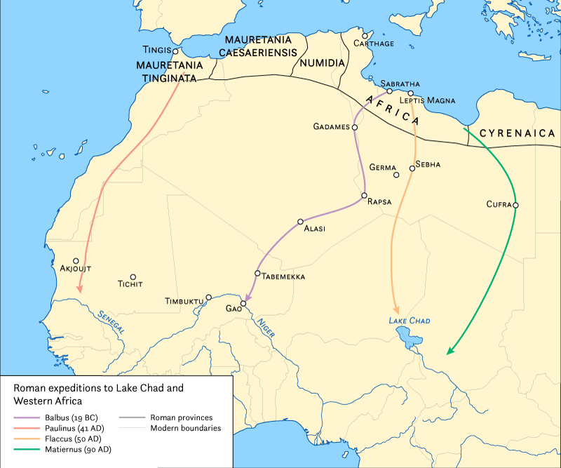
Oh! Also, you may be interested in the course of Roman military exploratory expeditions in Africa
Wonder why the apparent higher density depicted in places like Spain or France vs Italy.
the title let me think it is maps wigh roman roads excluded and not maps only with roman roads. But cool project. Also interesting how the citys used to be called.


